
![]()
THE GLOUCESTER & SHARPNESS CANAL NAVIGATION AND TOWPATH MAP - 2nd Edition
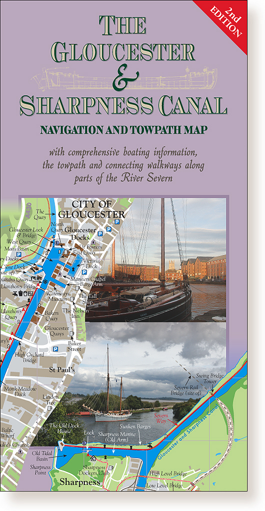
This
fully updated 2nd edition of the definitive map of The Gloucester & Sharpness Canal, with comprehensive boating
information (including visitor and long term moorings), the towpath and
connecting walkways along parts of the River Severn.
A highly detailed illustrated map showing this famous canal, Gloucester
and Sharpness Docks, with full historical and modern details.
Drawn in the same style and scale as our best-selling
Stroudwater Canal & Thames and Severn Canal Towpath
Map. Includes expanded sections showing parts of the River Severn with
some of the best wildlife and Severn Bore viewing locations, the Cambridge
Arm and the Slimbridge area.
A double-sided 500 x 624mm sheet map, folded to 250
x 126mm.
4 detailed full-colour map segments, 59 full-colour
photographs and 6 historical illustrations.
ISBN 978-1-902487-11-3
Price: £5.35 (+£2.50 UK P&P)
Copyright © 1998-2025 Darien-Jones Publishing. All rights Reserved.